What's New
Bug fix...
Bug fix...
Size:
225 MB
Category:
Navigation
Navigation
OS:
iOS
iOS
Price:
$5.99
$5.99
Compatible:
iPad
iPad
Requirements:
Requires iOS 5.0 or la
Requires iOS 5.0 or la
Version:
1.0
1.0
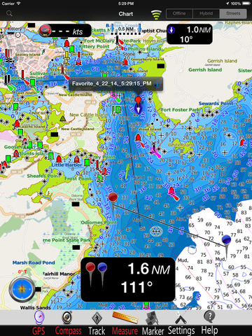
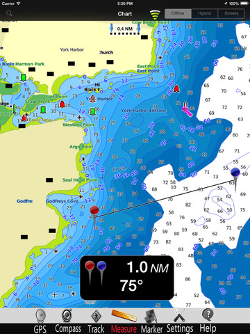
Description - New Hampshire nautical chart HD
.
If you are iPad owner,you now can download New Hampshire nautical chart HD for $5.99 from Apple Store. The application is available in multiple languages: English, French, Italian, Spanish. It weighs in at a hefty 225 MB, so make sure you have plenty of free space on your iOS device. The new New Hampshire nautical chart HD app version 1.0 has been updated on 2014-05-05. The Apple Store includes a very useful feature that will check if your device and iOS version are both compatible with the app. Most iPhone and iPad are compatible. Here is the app`s compatibility information: Requires iOS 5.0 or later. Compatible with iPad.
Bottom Line: For more information about New Hampshire nautical chart HD check developer MapITech`s website : http://www.mapitech.com
Bottom Line: For more information about New Hampshire nautical chart HD check developer MapITech`s website : http://www.mapitech.com
MapITech launch and brings on market the Best official up-to-date NOAA nautical charts, boat ramps Marinas, wrecks, fishing spot, POI. The interactive men is very intuitive, the maps are downloaded on the device itself, it works ...